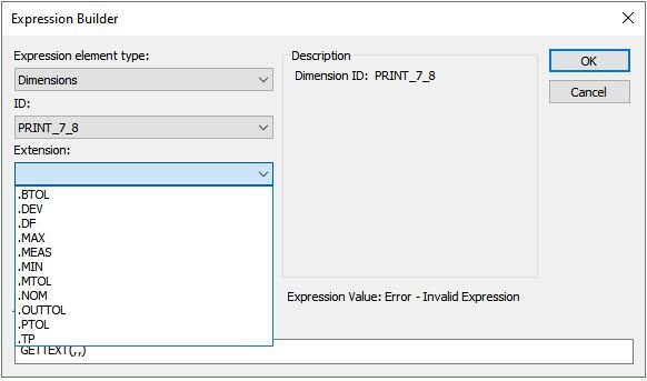
Is there a way to pull the data from the axis measurements in Geometric Tolerances? I cannot seem to find the correct method to get that data. Is it possible?
ah sorry that has to be the 1133 instead of "REPORT_LABEL_MEAS", my bad
this "REPORT_LABEL_..." always gives exactly 13 characters and then a Chr(13) character too end the line.
thats why Left(...,13) -> you can convert the rest into a number which removes the spaces
For some reason, I cannot edit my previous post...
However, when I do this, it returns a "0" rather than the angle or deviation on the angle. At this point, I will stick with my route unless I am missing something.
do you have time to find out why it doesn't work for you?
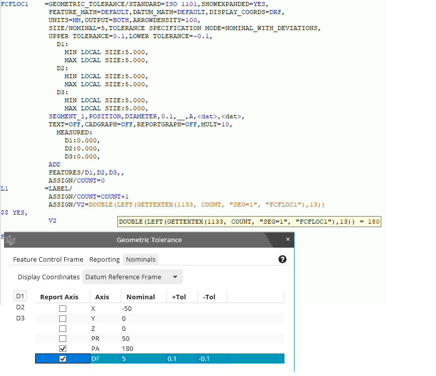
Of course, this assign code does not work if you have clicked on several axes, only "PA" and "DF" may be clicked because "PA" has to be in the first line.
do you have time to find out why it doesn't work for you?
Of course, this assign code does not work if you have clicked on several axes, only "PA" and "DF" may be clicked because "PA" has to be in the first line.
Ok
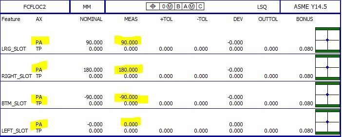
bfire85 what I discovered in Xactmeasure Probably the same for Geo, but when I created a position for 2 or more holes under Assignment this what you can extract, First pic, When you do single callouts, This is what you can extract, 2nd Pic
Ok bfire85 what I discovered in Xactmeasure Probably the same for Geo, but when I created a position for 2 or more holes under Assignment this what you can extract, First pic, When you do single callouts, This is what you can extract, 2nd Pic