hexagon logo

Generic feature doesn't match measured

Hello,

I need to show our customer the minimum and maximum of point on the surface.

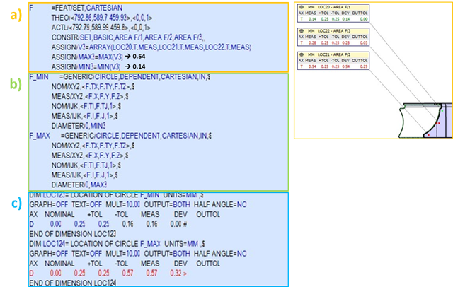
a) I measured individual vector points and created a set of points (Feature set). From the set of points I evaluate Minimum and Maximum with the code below.

b) Then I created a Generic Feature for Minimum and Maximum. Up to this point, everything is OK.

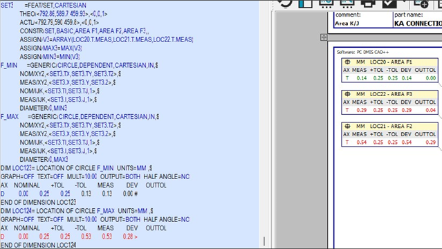
c) I created a Dimension Location, but the results are not correct.

Any ideas?

Parents
  • Longshot, but worth trying:

    Change your feature names from "AREA F/1", "AREA F/2", "AREA F/3" to something that doesn't have the "/" in it.
    Big chance PC-DMIS is treating the feature names as math formulas and you have another feature just named "F" so, there could be some confusion for PC-DMIS here.
    Try also adding more numbers/letters to the "F" feature name, not just one single letter.

Reply
  • Longshot, but worth trying:

    Change your feature names from "AREA F/1", "AREA F/2", "AREA F/3" to something that doesn't have the "/" in it.
    Big chance PC-DMIS is treating the feature names as math formulas and you have another feature just named "F" so, there could be some confusion for PC-DMIS here.
    Try also adding more numbers/letters to the "F" feature name, not just one single letter.

Children