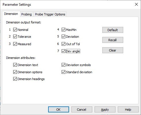
I started seeing that if I change the dimension format from this:
FORMAT/TEXT,OPTIONS,ID,HEADINGS,SYMBOLS,SD;NOM,TOL,MEAS,MAXMIN,DEV,OUTTOL,
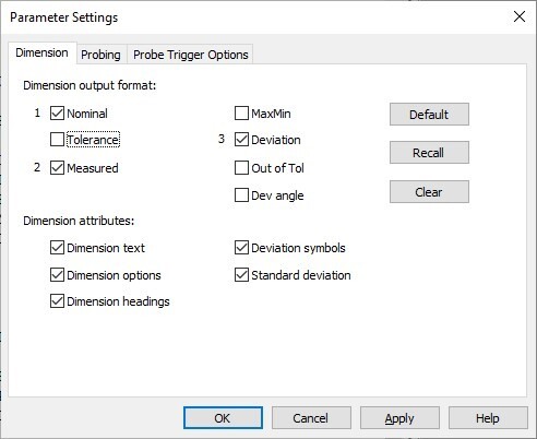
to this:
FORMAT/TEXT,OPTIONS,ID,HEADINGS,SYMBOLS,SD;NOM,MEAS,DEV,,,,
it messes up the display of GeoTol dimensions above the change. I've tried going in and "forcing" a change above each dimension line, but it doesn't affect it. The only thing that seems to work is to add OUTTOL to the line I want to NOT have OUTTOL on!
This is now an intermittent issue. In my experimenting, it magically worked one time, which I got a copy of, and then I tried being a good scientist and tried re-creating the issue, and it has never come back to "good".
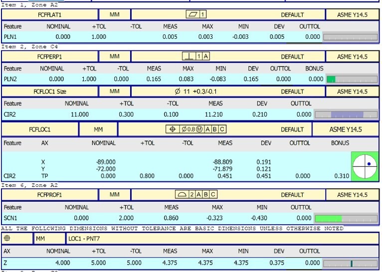
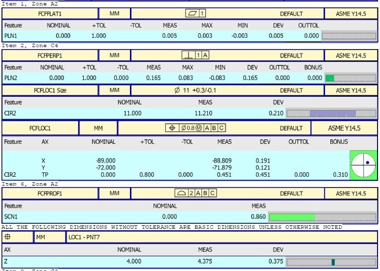
This is what I want:
This is what I keep getting:
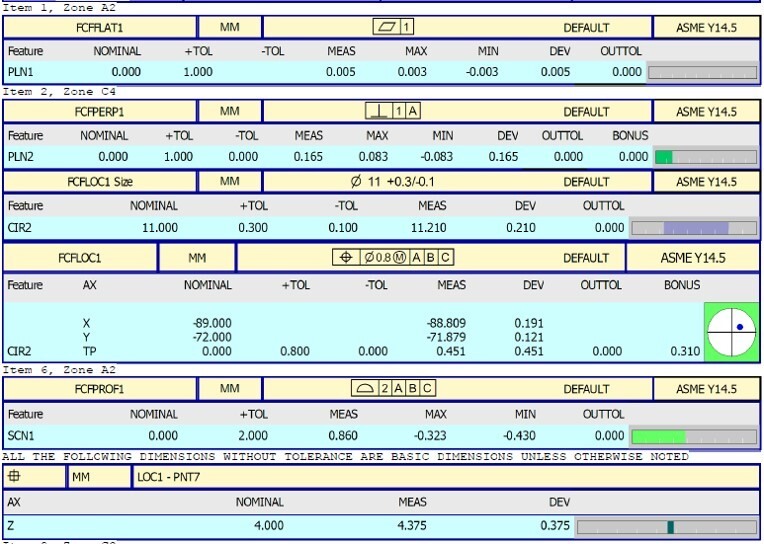
This is what I've had to settle for: