
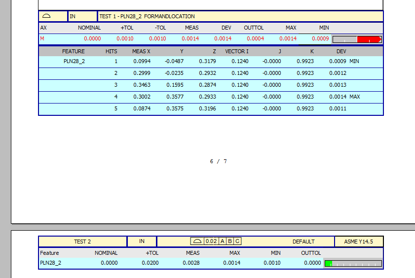
Fairly straight forward measurement. Plane on an angled surface opposite the A datum. which is also a plane. B is a line and C is a target point. I reported out the same plane in both geo and legacy. The min and max look the same besides 1/10" on the min. Legacy showing out of tolerance. Geo showing in. So my question is where is this 0.0028" measurement coming from? Running 2020r2.

